Recent searches
Search options

#mudslides


After wildfires, Los Angeles braces for flooding, mudslides, evacuation
More than 20 million people across Southern California are under flood watches.
#wildfires #flooding #mudslides #evacuation #LosAngeles #SouthernCalifornia
https://globalnews.ca/news/11080382/los-angeles-storm-california-floods-mudslides-evacuation/
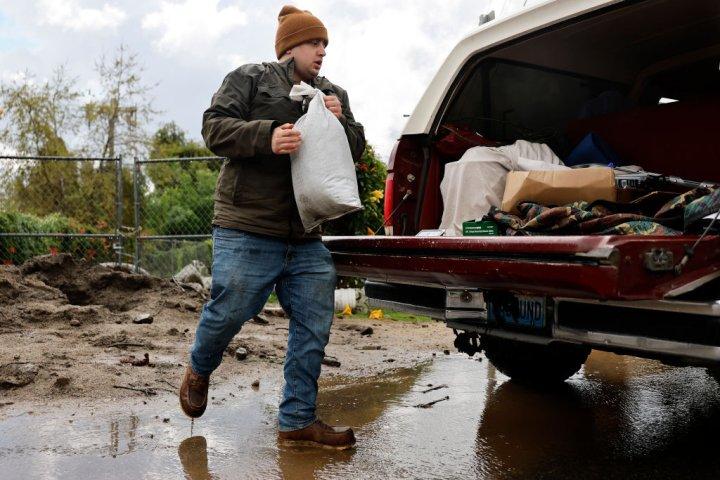

#Mudslides, 126-mph winds and feet of snow pummel #California amid #AtmosphericRiver
The biggest storm so far this winter blasted California with #flooding #downpours, #hurricane-force winds and feet of #snow in the mountains. Some of the worst damage occurred near the #BurnScars from January's deadly #fires.
By Brian Lada, AccuWeather meteorologist and senior content editor
Published Feb 14, 2025
"Mudslides, flooding downpours and feet of mountain snow were unleashed across California as the biggest storm so far this winter hit the state, including areas devastated by deadly #wildfires in January.
"Evacuations were ordered and roads were shut down near the burn scars of the #PalisadesFire and the #EatonFire due to the risk of mudslides, flash flooding and debris flows, including a stretch of the #PacificCoastHighway between #Malibu and #SantaMonica.
"A person with the Los Angeles Fire Department was swept away in a vehicle amid the flooding but managed to escape with only minor injuries, according to The Associated Press.
"Bulldozers were needed to clear feet of mud, rock and debris from some roads as the heavy rain ran off the charred mountainsides.
"'Over 10 inches of rain fell in some areas, including 10.87 at Manchester, on the coast west of #Sacramento, and 9.89 inches at Mining Ridge, 90 miles south of #SanJose,' AccuWeather Meteorologist and Digital Producer Jesse Ferrell said.
"Rain even fell in California's #DeathValley National Park, with 0.18 of an inch falling in the hottest place in North America. In an entire year, the remote park typically measures 2.20 inches of rain."
Read more:
https://www.accuweather.com/en/winter-weather/mudslides-126-mph-winds-and-feet-of-snow-pummel-california-amid-atmospheric-river/1745097#google_vignette
#ClimateCrisis #ClimateThreats #ClimateCatastrophe #ExtremeWeather #Polycrisis

"As much needed rain falls across #LosAngeles and Ventura Counties and gives firefighters relief from ongoing wildfires, officials are warning residents of hazardous waste, toxic ash runoff and #mudslides."
Risk rises for #mudslides around #LACounty fire zones; prepare for worst-case scenario, officials warn
Alene Tchekmedyian, Rong-Gong Lin II, Melody Gutierrez, LA Times
January 26, 2025
"With more rain on the way, officials warned Sunday of an increasing risk of mudslides in #LosAngelesCounty's burn areas, with a 10% to 20% chance of significant #FlashFlooding and #DebrisFlows capable of damaging roads and homes in and around areas devastated by #wildfires.
"'This is the worst-case scenario to prepare for,' said Kristan Lund, a meteorologist with the National Weather Service in Oxnard.
"'We do have increasing concern for the #BurnScars,' Lund said. The charred footprint of the Eaton fire, which blackened more than 14,000 acres, is the most worrisome. 'These #FlashFloods and these debris flows could happen in and near or below these burn scars.'
"A #FloodWatch took effect at 10 a.m. Sunday and was set to continue through 4 p.m. Monday for the burned areas of the #EatonFire in the #Altadena and #Pasadena areas; the #PalisadesFire and #FranklinFires in the Pacific Palisades and Malibu areas; the Hughes fire around Lake Castaic; and the Bridge fire in the San Gabriel Mountains west and southwest of Wrightwood. The flood watch started six hours earlier than originally anticipated as rain began falling steadily around Los Angeles."
Read more:
https://www.aol.com/news/risk-rises-mudslides-around-l-170323295.html
#ClimateCrisis #CaliforniaFires #BurnScar #FlashFloodWarning #FloodDanger #Mudslides #CaliforniaWx
#TropicalStormSara to unleash life-threatening #flooding in #CentralAmerica
Tropical Storm Sara will bring an extreme risk to lives and property in Central America where feet of rain may fall before tracking toward #Florida next week.
By Alex Sosnowski, AccuWeather senior meteorologist
Published Nov 14, 2024
"Rain may pour down for days on the northern parts of #Nicaragua and #Honduras before shifting to eastern parts of #Guatemala, #Belize and southeastern #Mexico this weekend.
"A general 8-12 inches (20-30 cm) will fall in this zone, but a large pocket of 12-18 inches (30-45 cm) of rain is forecast from northern Honduras and Nicaragua, with an AccuWeather Local StormMax™ of 50 inches (127 cm).
"'This amount of rain will trigger major #FlashFlooding and #mudslides with the potential for catastrophic loss of life and tremendous damage,' AccuWeather Chief Meteorologist Jonathan Porter warned.
"Some communities could be cut off for days due to washed-out roads and bridges or blocked by debris flows. Demands for rescue and recovery efforts, as well as food and medical supplies, will be great in the wake of the storm in the region.
"Because of Sara's proximity to the #Caribbean for several days, it will likely not unwind fully. As a result, winds, waves and #StormSurge will blast the coast of #Honduras, eastern #Guatemala, #Belize and Mexico's #Yucatan Peninsula. Sporadic #PowerOutages are likely due to #StrongWinds."
#CentralAmericaWx #ExtremeWx
#ExtremeRains #ExtremeWeather #ClimateChange #ClimateCrisis
#ClimateCatastrophe